Khuza'a is razed — from orbit, the world watches
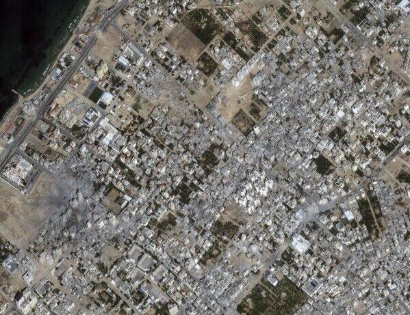
Amnesty International publishes satellite imagery showing the southern Gaza town of Khuza'a flattened almost in its entirety between January and May 2025. The release becomes a textbook case of evidence the public would not otherwise have.
A working catalogue entry, kept current. Each paragraph is drawn from the publicly documented record.
On 6 June 2025 Amnesty International publishes a satellite-evidence report on Khuza'a, a town of roughly 11,000 people in southern Gaza. Comparing imagery from January, March and May 2025, Amnesty's evidence lab concludes that more than 90% of Khuza'a's built structures have been levelled, and that the destruction took place after the Israeli forces had already withdrawn frontline units — that is, in conditions Amnesty describes as deliberate, post-combat demolition.
The report is only possible because some commercial imagery of southern Gaza is still being released, late and at lower resolution, into the commercial market. It also becomes a live counter-argument to operator self-censorship: when imagery does reach the public, it is the single most decisive piece of evidence in war-crimes investigations, and the only one no party to the conflict can fully suppress.
Each entry is publicly documented. Have a correction or a stronger source? Send it to the editorial team via the contact form.