
Critical Minerals — Energy, Mining, Utilities & Industrial Operations — Satellize
11.8Subsection · 5 applications

Critical Minerals
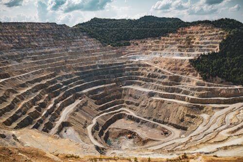
Workers in high-visibility vests at a lithium brine evaporation pond in a vast desert salt flat
Aerial views of open-pit mines help satellites pinpoint critical mineral deposits, guiding sustainable resource extraction worldwide.

Satellite Mapping of Critical Mineral Deposits

  1. 1
    Observation
    Multispectral SAR satellites scan mineral terrains
  2. 2
    Downlink
    Raw spectral imagery sent to ground stations
  3. 3
    Analytics
    AI detects lithium, cobalt, rare-earth signatures
  4. 4
    Mine Operator
    Priority drill-site maps guide extraction decisions
Satellites scan remote terrain and deliver AI-processed mineral maps directly to mine operators for targeted extraction.